NASA's Curiosity Mars Rover

397 readers
5 users here now

A lemmy community for scientific discussion of the Curiosity Rover and Mars Science Laboratory.

founded 1 year ago
MODERATORS
1


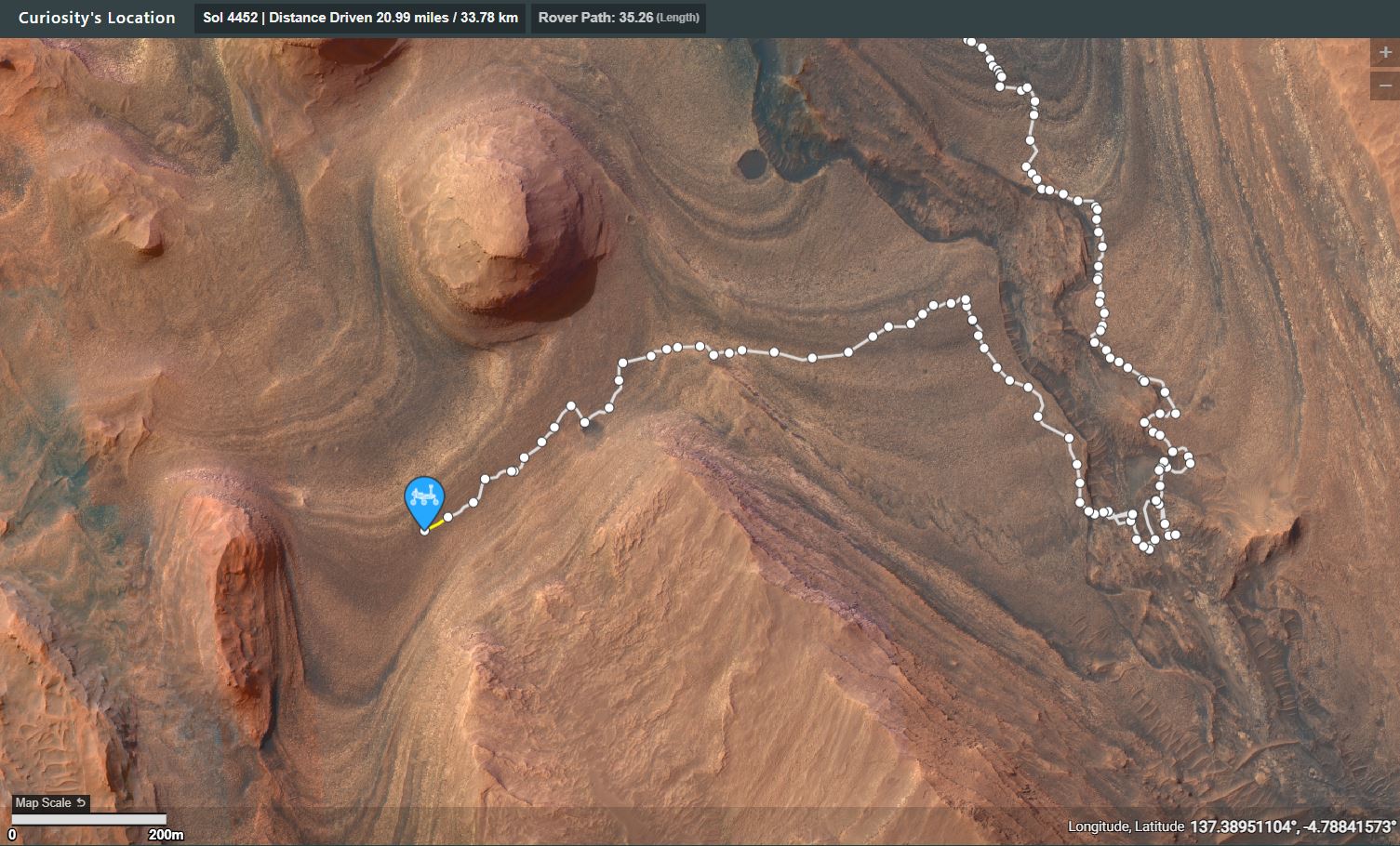
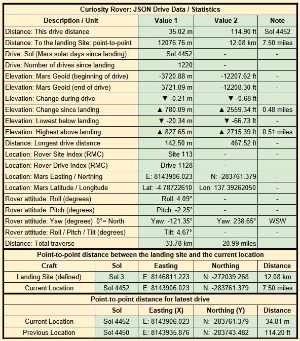
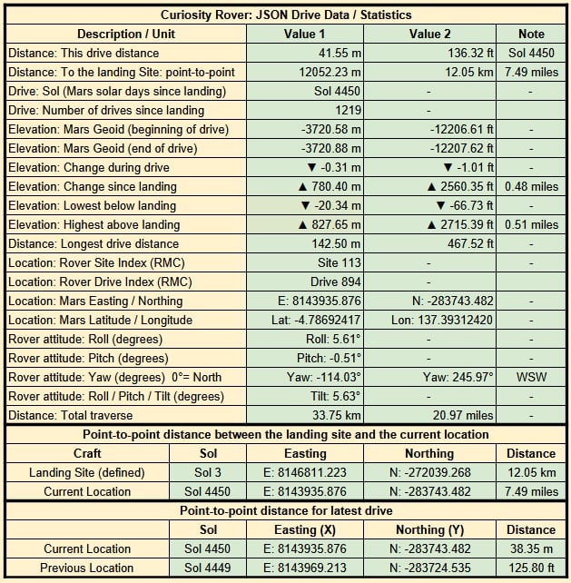
Earth planning date: Friday, Feb. 21, 2025

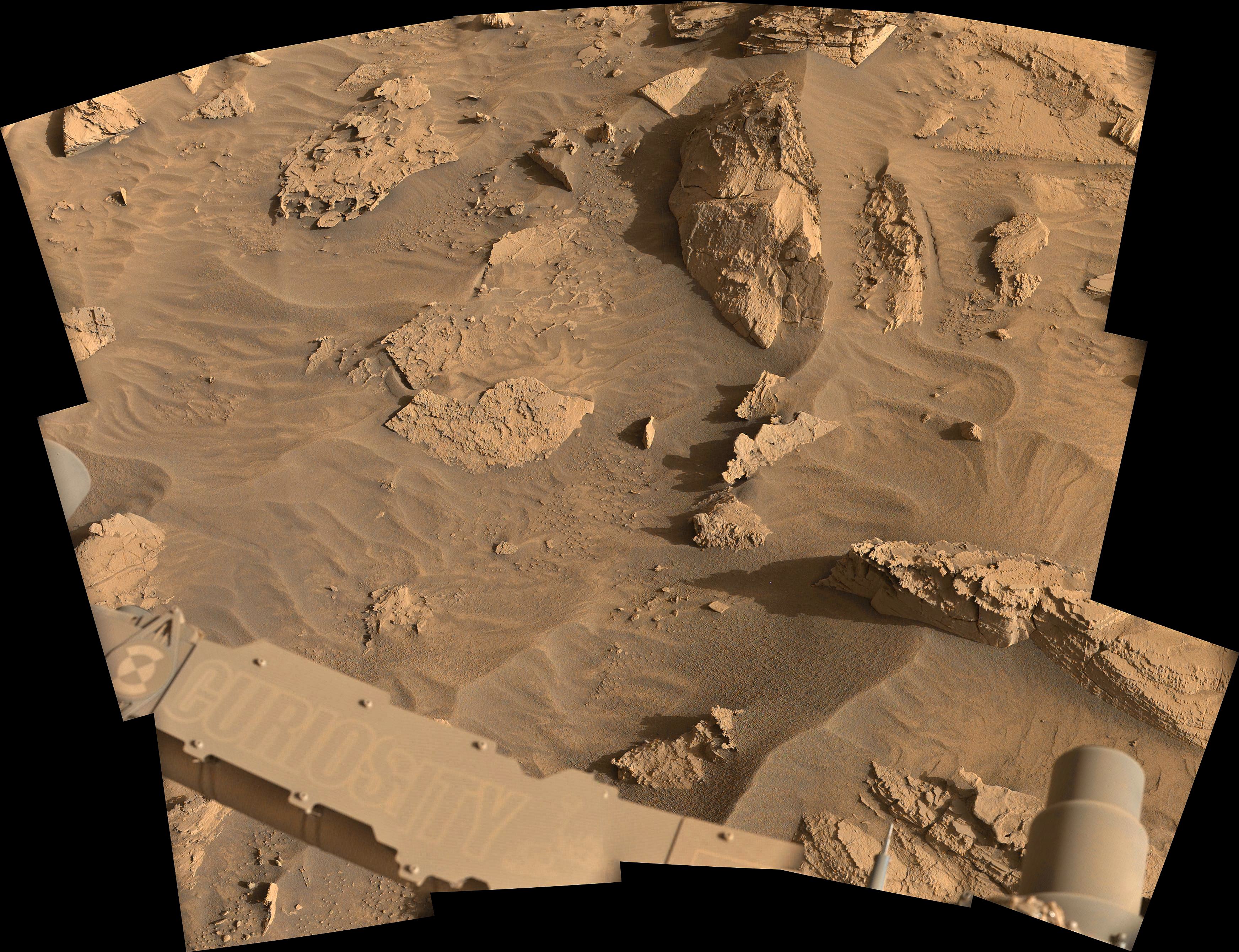
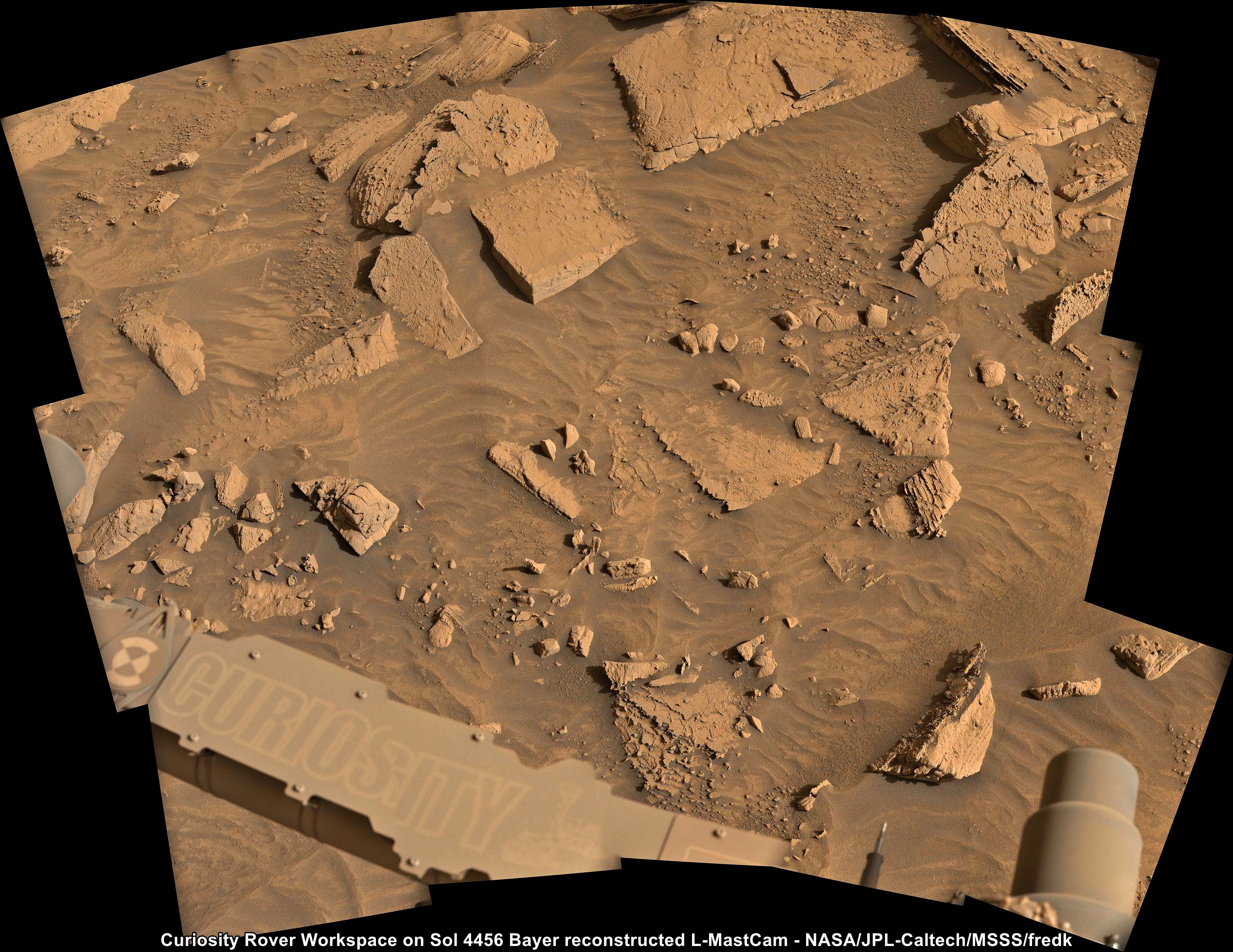
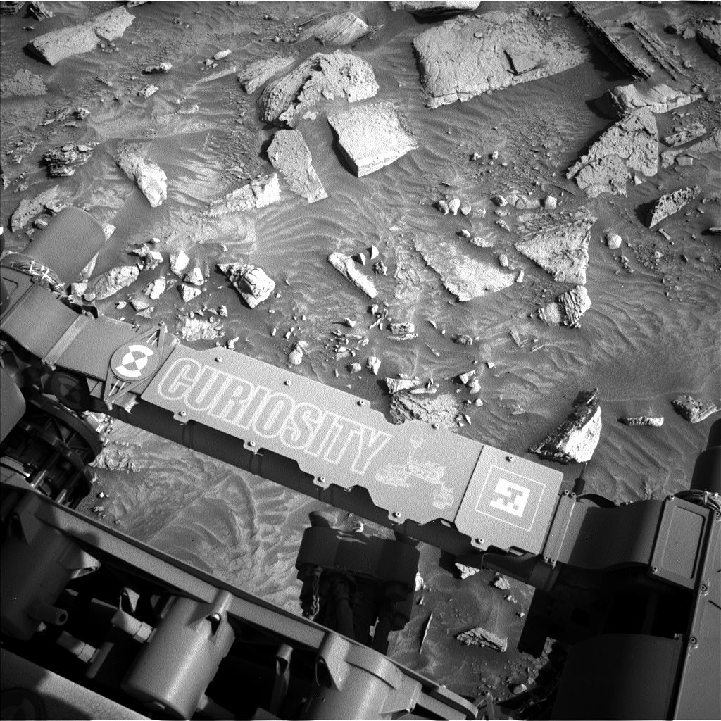
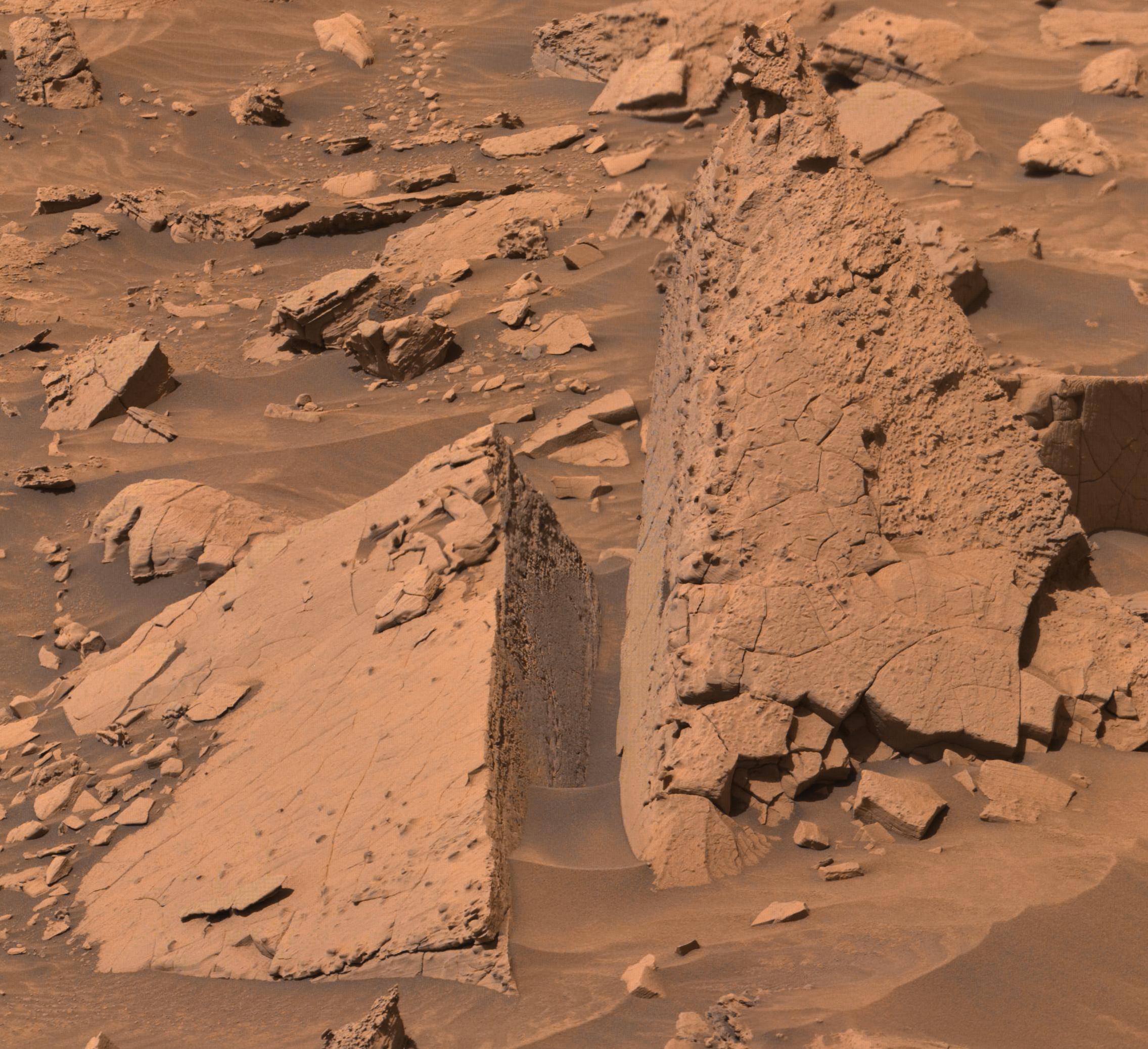
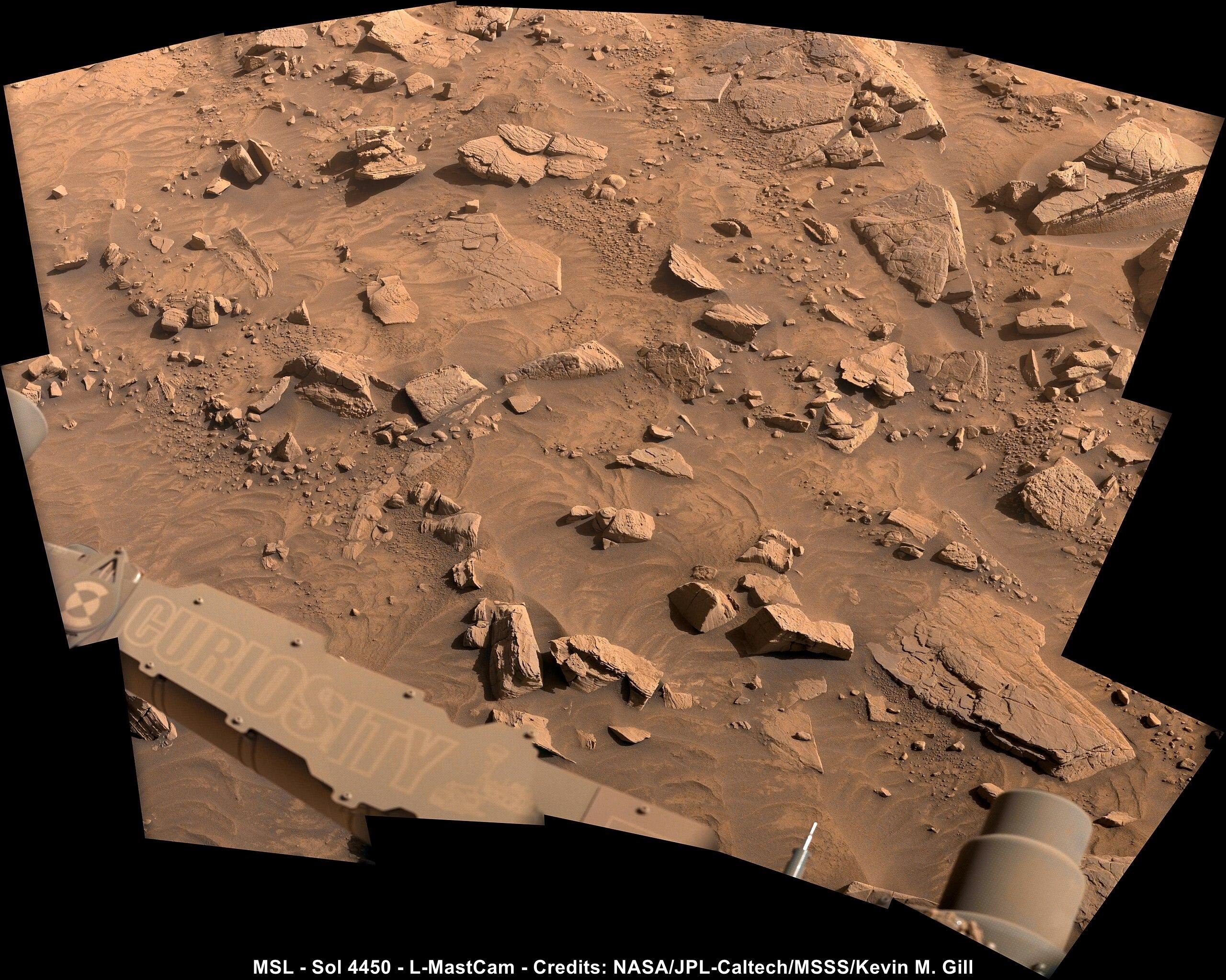
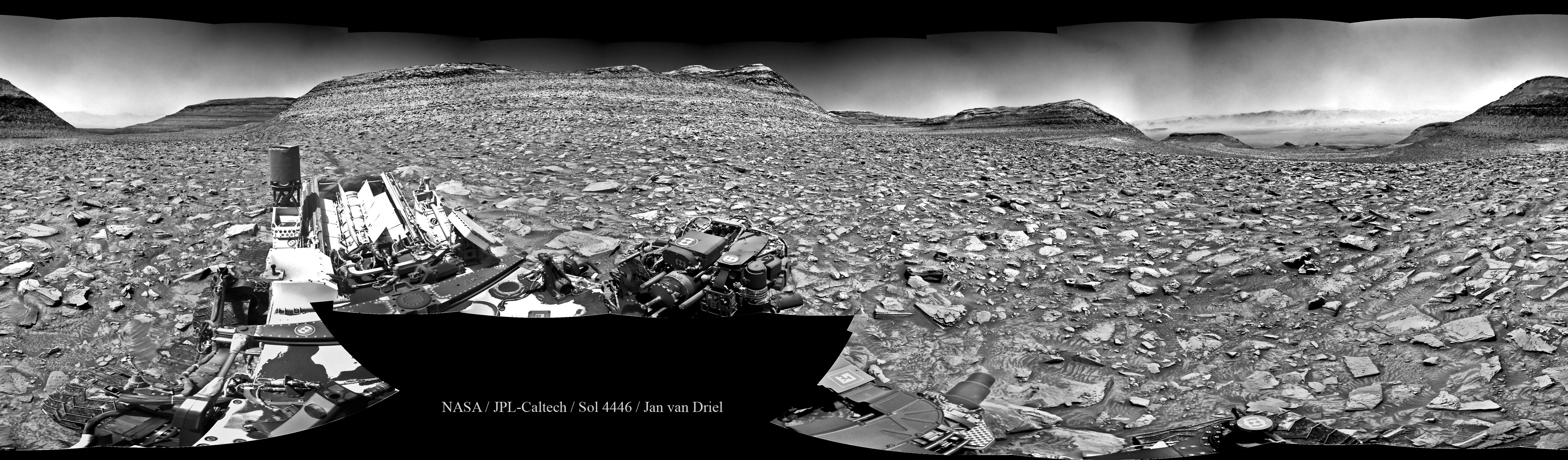
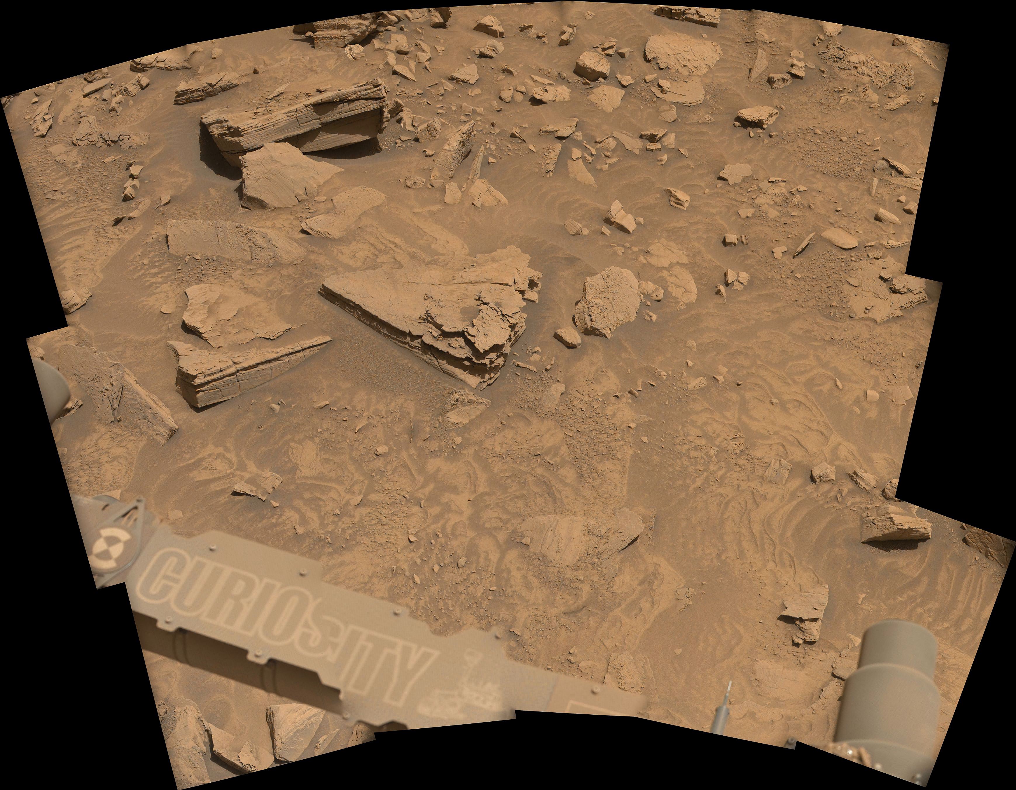
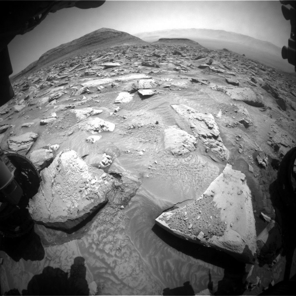
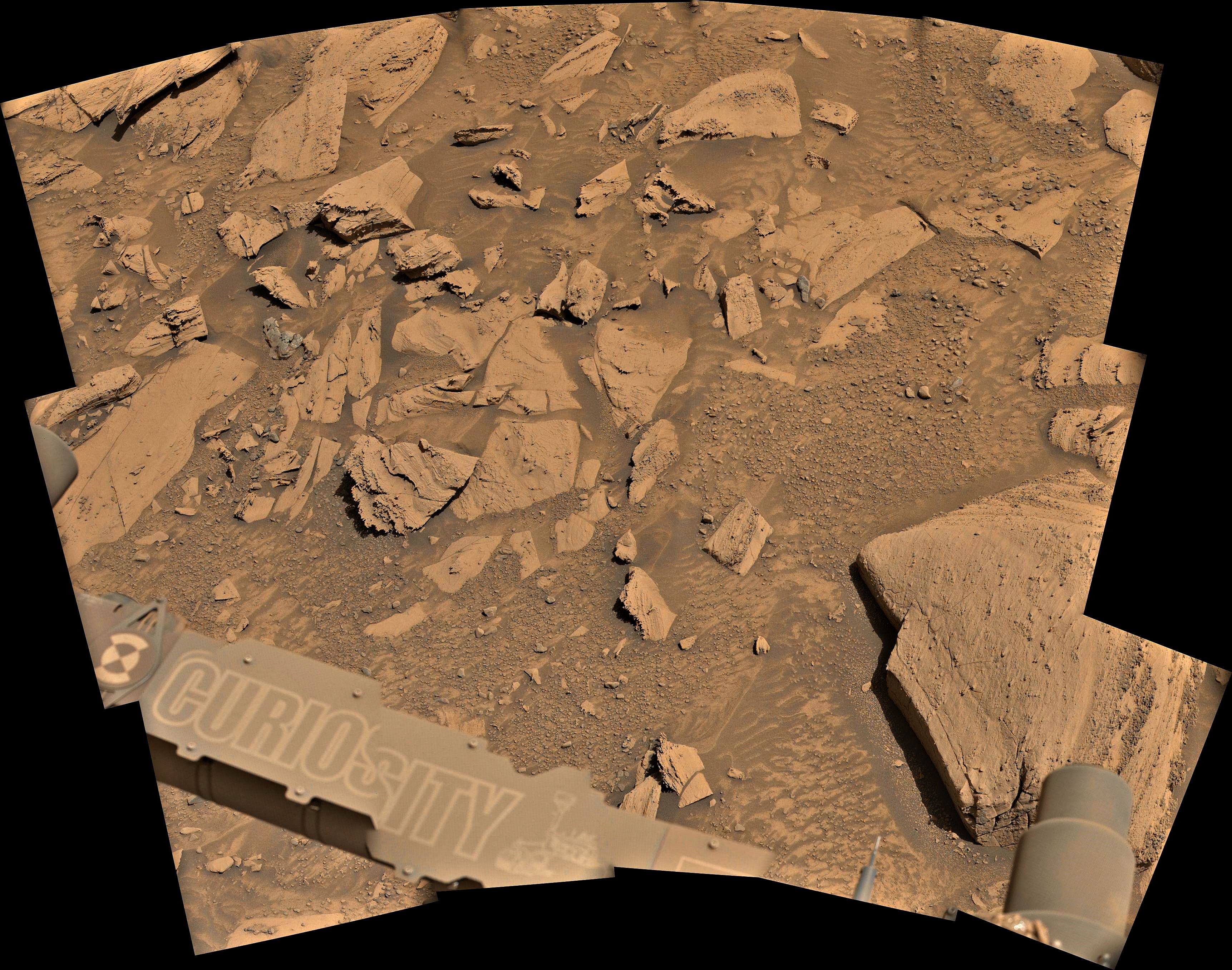
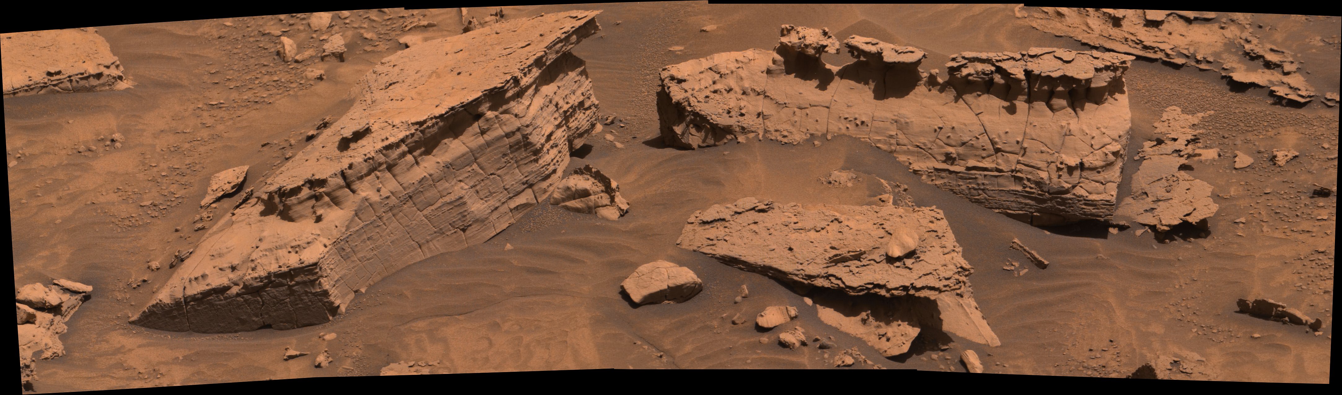
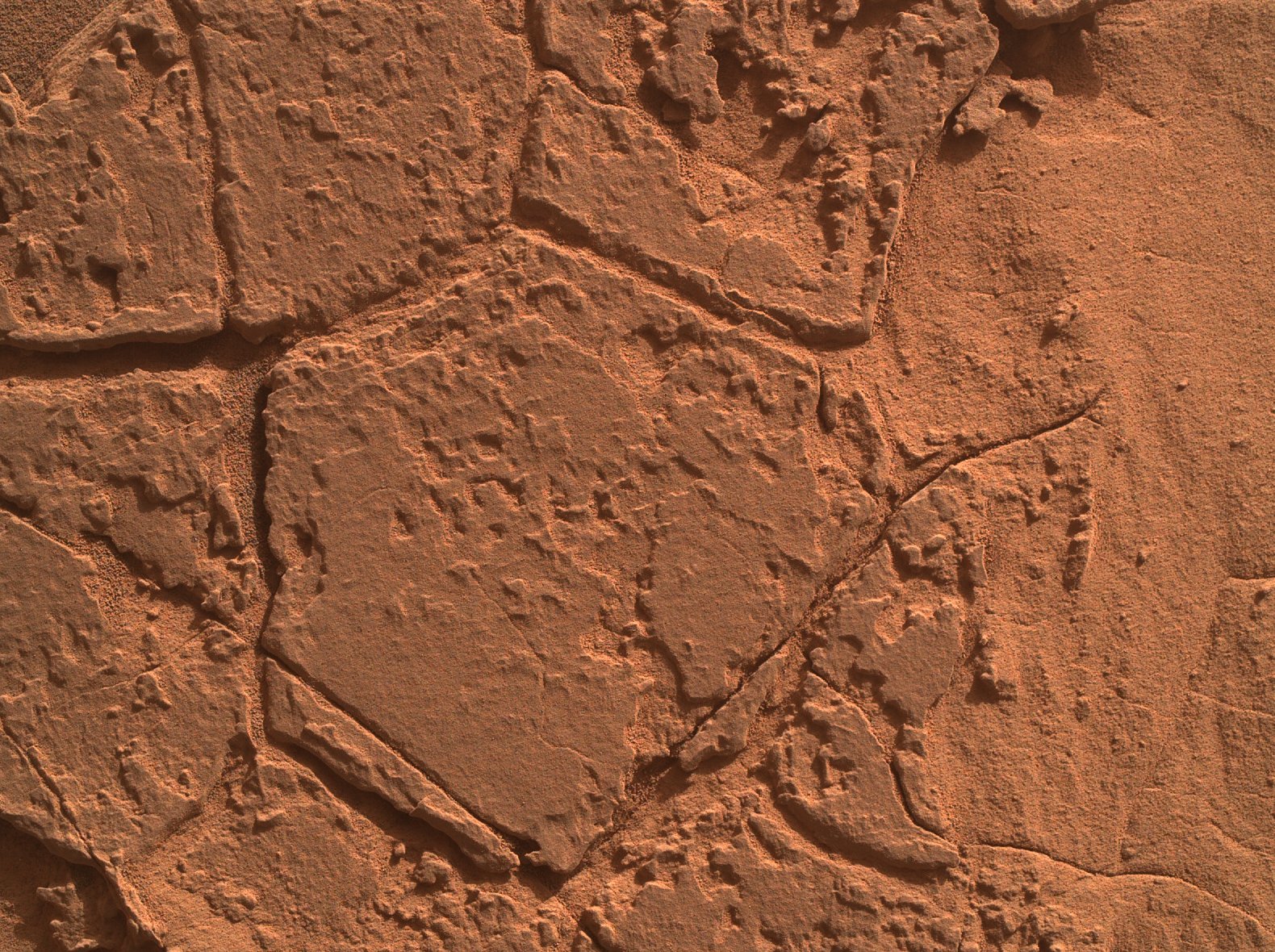
Since first encountering the sulfate-bearing unit around Sol 3540, we have detected minerals and elemental concentrations consistent with the presence of various salts and a general drying out of Mars climate (read ”NASA’s Curiosity Mars Rover Reaches Long-Awaited Salty Region”). Salton Sea in California is a saline lake, meaning it has high concentrations of salty minerals formed as a result of evaporation processes dominating over input of fresh water. As such, we thought it would be a fitting name for one of our rock targets to be analyzed by the APXS and MAHLI instruments in this weekend plan. We have observed a variety of different textures and colors associated with the sulfate-bearing unit. The target “Salton Sea” is an example of one such texture — a dark-toned, relatively smooth, platy layer. Will the chemistry indicate the presence of salty minerals, some of which may be the same as those found at Salton Sea? Other rock targets to be analyzed in this busy weekend plan include “Wellman Divide,” another APXS and MAHLI target on a thicker, dark-toned, rougher textured layer, and “Goodykoontz” and “Paseo del Mar,” both ChemCam LIBS targets, on a nodule and a dark, platy layer, respectively.

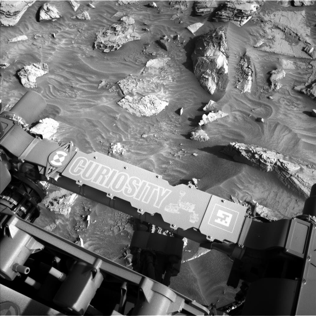
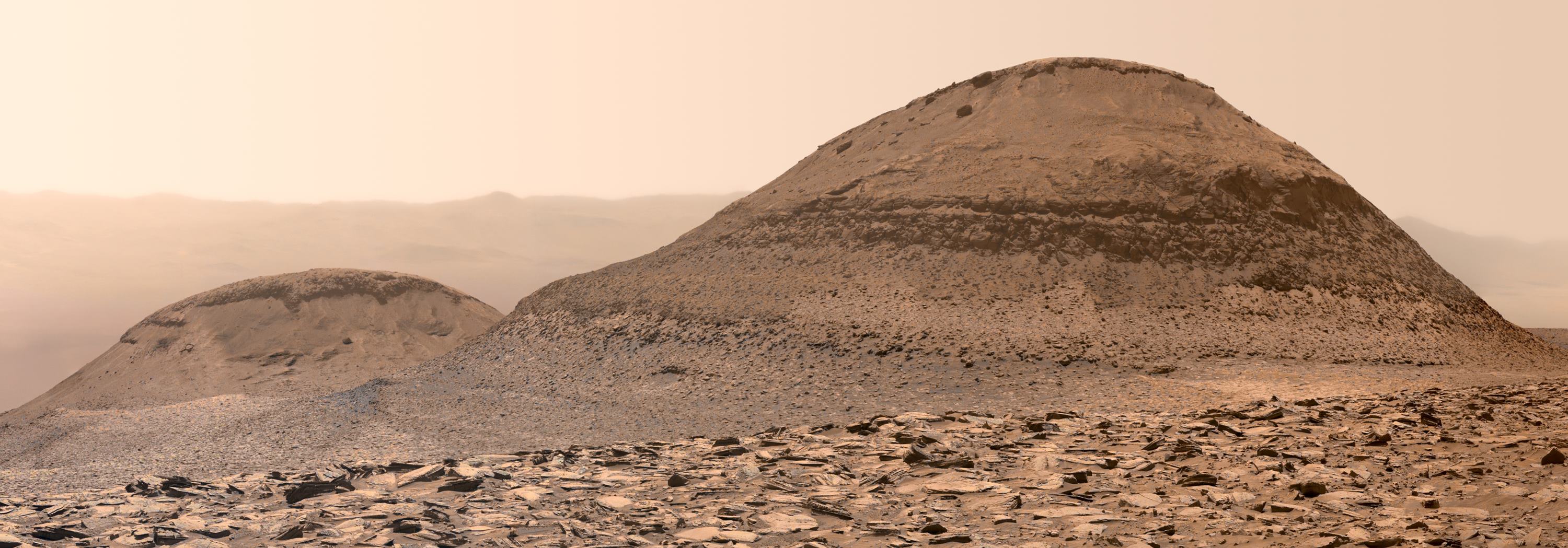
We also continue to document the layers of rock exposed within several buttes and mesas around us (“Dragon Tooth” and “Texoli” buttes, and “Gould Mesa”) with CCAM RMI and Mastcam imaging. Curiosity will hopefully climb though equivalent layers as we continue our ascent of Mount Sharp, so these images can help with interpretation when we finally encounter them on the ground. Mastcam will also image a trough in the sand surrounding one of the bedrock blocks — a feature that has been observed relatively frequently lately.

The atmospheric scientists also have an action-packed plan with coordinated APXS atmospheric and ChemCam passive-sky observations to measure argon and oxygen, respectively, as well as standard activities. These observations help to track changes in seasonal atmospheric flow from equatorial to polar regions on Mars. Standard atmospheric monitoring activities included in the plan are: Navcam dust devil movies (x2), suprahorizon movies (x2), a zenith movie, line of sight observations (x2), and a cloud altitude observation, as well as Mastcam tau observations (x2).

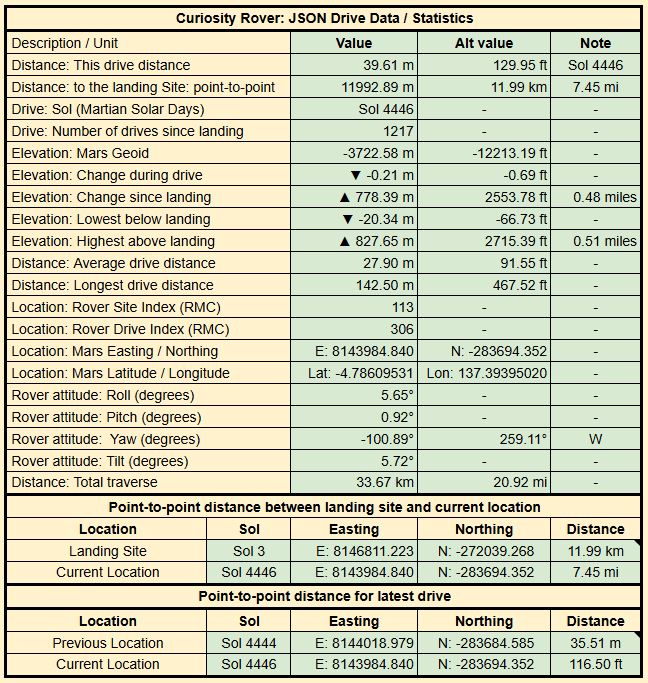
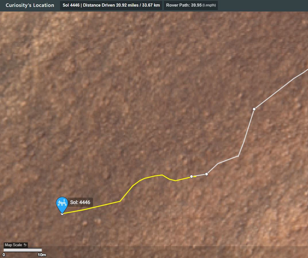
After a planned drive of about 49 meters (about 161 feet) on the second sol of this three-sol weekend plan, the MARDI camera will take an image of the terrain beneath the rover. The plan is rounded out with standard REMS, DAN and RAD activities.

Written by Lucy Thompson, Planetary Geologist at University of New Brunswick

2


Credits for the de-Bayered frames: NASA/JPL-Caltech/MSSS/fredk

3


New workspace (L-NavCam) and details of the drive of 49.56 meters SSW during sol 4462 to site 113.2040 will be posted in the comments

NASA/JPL-Caltech

4


Credits: NASA/JPL-Caltech/MSSS/Kevin M. Gill

Source

5
6
7


From the Article:

"The Curiosity rover discovered evidence for long-lived ancient lakes in 2014, and now 10 years later Curiosity has discovered ancient lakes that were free of ice, offering an important insight into the planet's early climate."

8


L-MastCam mosaic of the sol 4456 Workspace. Assembled in MS-ICE using fredk's Bayer reconstructed frames

15 frames from the L-MastCam

Credits: NASA/JPL-Caltech/MSSS/fredk

9


Drive data

New workspace

Credits: NASA/JPL-Caltech/UofA

10


Sol 4454 MastCam mosaic of target “Pyramid Lake” from Kevin M Gill

Credit: NASA/JPL-Caltech/MSSS/Kevin M. Gill

Source

11


Earth planning date: Friday, Feb. 14, 2025

Curiosity is continuing to make progress along the strategic route, traversing laterally across the sulfate (salt) bearing unit toward the boxwork structures. The team celebrated the completion of another successful drive when we received the downlink this morning, and then we immediately got to work thinking about what’s next. There is a holiday in the United States on Monday, so instead of the typical three-sol weekend plan, we actually planned four sols, which will set us up to return to planning next Tuesday.

The first sol of the plan focuses on remote sensing, and we’ll be taking several small Mastcam mosaics of features around the rover. One of my favorite targets the team picked is a delightfully pointy rock visible toward the left of the Navcam image shown above. The color images we’ll take with Mastcam will give us more information about the textures of this rock and potentially provide insight into the geologic forces that transformed it into this comical shape. The team chose what I think is a very appropriate name for this Martian pyramid-shaped target — “Pyramid Lake.” The terrestrial inspiration behind this name is a human-made reservoir (lake) near Los Angeles with a big (also human-made) pyramidal hill in it.

On the second sol of the plan, we’ll use the instruments on Curiosity’s arm to collect data of rock targets at our feet, including “Strawberry Peak,” a bumpy piece of bedrock, “Lake Arrowhead,” a smooth piece of bedrock, and “Skyline Trail,” a dark float rock. ChemCam will also collect chemical data of Skyline Trail, “Big Tujunga” — which is similar to Strawberry Peak — and “Momyer.” We’ll also take the first part of a 360-degree color mosaic with Mastcam!

In the third sol of the plan, we’ll complete the 360-degree mosaic and continue driving to the southwest along our strategic route. The fourth sol is pretty quiet, with some atmospheric observations and a ChemCam AEGIS. Atmospheric observations are additionally sprinkled throughout other sols of the plan. This time of year we are particularly interested in studying the clouds above Gale crater!

I’m looking forward to the nice long weekend, and returning on Tuesday morning to see everything Curiosity accomplished.

Written by Abigail Fraeman, Planetary Geologist at NASA's Jet Propulsion Laboratory

12


Earth planning date: Wednesday, Feb. 12, 2025

I woke up this morning to my weather app telling me it felt like minus 15° C (5°F) outside. On days like this, it can take me a little longer to get myself up and out into the world. Curiosity has a similar problem — as we head toward winter and it gets colder and colder in Gale Crater, Curiosity has to spend more time warming up to do things like driving and all our good science. I’ve also been watching a couple winter storms that are expected in the next few days here in Toronto. Luckily, Curiosity doesn’t have to deal with snowstorms, and our drive in the last plan went ahead as planned and put us in a good position to go ahead with contact science today, a relief after having to forego it on Monday.

The contact science location that the geology team chose is called “Catalina Island,” the flat rock you can see in almost the center of the image above. As you can likely also see above, there’s a whole jumble of rocks in that image, and Mastcam and ChemCam have picked out a couple others to take a look at. These are “Point Dume,” which will be the target of ChemCam’s laser spectrometer, and “Whittier Narrows,” on which Mastcam will image some linear features. Mastcam and ChemCam are also turning their gazes further afield for Mastcam targets “Cleghorn Ridge,” “Cuyamaca Peak,” “Kratka Ridge,” and two long-distance ChemCam mosaics of the top of the Wilkerson butte and a spot a little further down known as “Pothole Trail.”

Much like I’m keeping an eye out the window on the changing weather here, Curiosity is also continuing to keep an eye on the environment in Gale Crater. Even though it’s not the dusty season, we continue to monitor the dust around us and in the atmosphere with a dust-devil survey and a tau. But we’re especially interested in what the clouds are up to right now, which we’re checking in on with our normal zenith and suprahorizon movies, and our cloud-season-only Phase Function Sky Survey. This is a series of movies covering the whole sky that we can use to determine how sunlight interacts with the individual water-ice crystals in the clouds.

Written by Alex Innanen, Atmospheric Scientist at York University

13


NASA/JPL-Caltech/UofA

14
 
 
15


Drive data

The workspace mosaic is from Kevin Gill as I failed to assemble the images in MS-ICE. Credits: NASA/JPL-Caltech/Kevin M. Gill

The drive data is processed from the JSON information updated by JPL shortly after each drive

16
17


News Release from NASA

18


Mars is pummeled by rocks from space every day and some are big enough to make a big splash. A recent impact blew out a house-sized crater and hurled debris nearly 3 kilometers (~1.9 miles) away. And it may have even exposed buried ice.

19


Credits: NASA/JPL-Caltech/Jan van Driel

20


L-MastCam mosaic assembled in MS-ICE from 15 post-drive Bayer reconstructed images.

Here's the drive data

Map: The drive path is shown in yellow, there is a scale bar, North is up. Note the short drive East to free itself from the rock that stopped the previous drive short, before it drove to the West.

21


Earth planning date: Wednesday, Feb. 5, 2025

Overnight before planning today, Mars reached a solar longitude of 40 degrees. The solar longitude is how we like to measure where we are in a Mars year. Each year starts at 0 degrees and advances to 360 degrees at the end of the year. For those of us on the Environmental Science (ENV) team, 40 degrees is a special time as it marks the beginning of our annual Aphelion Cloud Belt (ACB) observation campaign. During this time of year, the northern polar ice cap is emerging into the sunlight, causing it to sublimate away and release water vapor into the atmosphere. At the same time, the atmosphere is generally colder, since Mars is near aphelion (its furthest distance from the Sun).

Together, these two factors mean that Mars’ atmosphere is a big fan of forming clouds during this part of the year. Gale is right near the southern edge of the ACB, so we’re starting to take more cloud movies to study how the ACB changes during the cloudy season. (Jezero Crater, home to Perseverance, is much closer to the heart of the ACB, so keep an eye on their Raw Images page over the next several months as well.

The drive from Monday’s plan ended early, after just about 4 meters instead of the 38 meters that had been planned (about 13 feet vs. 125 feet). We initially thought this might have been because our left-front wheel ran into the side of a large rock (see the image above), but after we got our hands on the drive data, it turned out that the steering motor on the right front wheel indicated that a rock was in the way on that side too, so Curiosity stopped the drive to await further instruction from Earth. This is a well-understood issue, so we should be back on the road headed west today.

The cold weather is still creating power challenges, so we had to carefully prioritize our activities today. Despite the drive fault, we received the good news that it was safe to unstow the arm, so we were able to pack in a full set of MAHLI, APXS, and DRT activities. Before that, though, we start as usual with some remote sensing activities, including ChemCam LIBS and Mastcam observations of “Beacon Hill” (some layered bedrock near the rover) and a ChemCam RMI mosaic of the upper portion of Texoli butte.

After taking a 3½-hour nap to recharge our batteries, we get into the arm activities. These start off with some MAHLI images of the MAHLI and APXS calibration targets, then continue with MAHLI and APXS observations of “Zuma Canyon.” This is followed by DRT, APXS, and MAHLI activities of some bedrock in our workspace, “Bear Canyon.” Although we then take another short nap, we don’t yet stow the arm as we have a pair of lengthy post-sunset APXS integrations. The arm is finally stowed about an hour and a half before midnight.

The second sol of this plan begins with some more remote sensing activities, starting with ChemCam LIBS on “Mission Point”. This is followed by a series of Mastcam images of “Crystal Lake” (polygonal fractures in the bedrock), “Stockton Flat” (fine lamination in the bedrock), “Mount Waterman,” and Mission Point. We then finish with some ENV activities, including a Mastcam tau and Navcam line-of-sight to measure dust in the atmosphere and a Navcam cloud movie. This plan ends with a (hopefully!) lengthy drive west and many hours asleep to recharge our batteries as much as possible before planning starts again on Friday. Of course, I would be remiss if I didn’t mention that REMS, RAD, and DAN continue to diligently monitor the environment throughout this plan.

Written by Conor Hayes, Graduate Student at York University

Link: https://science.nasa.gov/blog/sols-4445-4446-cloudy-days-are-here/

22


Mosaic of 15 overlapping Bayer reconstructed L-MastCam frames

Credits: NASA/JPL-Caltech/MSSS/fredk

23


The Bayer compressed base images were acquired by Curiosity's MAST_RIGHT camera during mission Sol 4439 (31 Jan 2025). The images were processed by Kevin M. Gill

Credits: NASA/JPL-Caltech/MSSS/Kevin M. Gill

Source - https://www.flickr.com/photos/kevinmgill/54301632237

24


Mars rover Curiosity acquired this image using its Mars Hand Lens Imager (MAHLI), located on the turret at the end of the rover's robotic arm, on February 2, 2025, Sol 4441 of the Mars Science Laboratory Mission, at 08:40:11 UTC.

The camera focus motor count (returned with the image) can be used to calculate the camera standoff distance (camera lens to the target). In this case the standoff was 25 centimeters (~10 inches). This provides an image scale of ~95 micrometers per image pixel, or a scene width of ~15 centimeters (~6 inches)

Most images acquired by MAHLI in daylight use the sun as an illumination source. However, in some cases, MAHLI's two groups of white light LEDs and one group of longwave ultraviolet (UV) LEDs might be used to illuminate targets. When Curiosity acquired this image, the group 1 white light LEDs were off, the group 2 white light LEDs were off, and the ultraviolet (UV) LEDS were off.

Credits NASA/JPL-Caltech/MSSS/Kevin M. Gill

Source - https://www.flickr.com/photos/kevinmgill/54303529791/

25


Earth planning date: Friday, Jan. 31, 2025

Here in Earth’s northern hemisphere, the days are slowly getting longer, bringing with them the promise of an end to winter. While we are anticipating the return of warmer temperatures, just over 100 million kilometers (more than 62 million miles) away, Curiosity is starting to feel the bite of the colder season.

One of the quirks of Mars’ orbital configuration is that aphelion (when Mars is farthest from the Sun) occurs about a month and a half before the southern winter solstice. This means that winters in the southern hemisphere (where Curiosity is located) are both longer and colder than those in the northern hemisphere. Consequently, we need to spend more of our power on keeping the rover warm, limiting the time that can be spent doing science.

Today’s plan was fairly constrained by the available power, so our various instrument and science teams had to carefully coordinate their requests to ensure that we stay within the power limits that have been budgeted out over the next several plans. Our team is never one to back down from a challenge, so this plan squeezes as much science as possible out of every watt-hour of power we were given.

Our drive from Wednesday’s plan completed successfully (quite an accomplishment in the current terrain!). One of our wheels ended up perched a few centimetres up on a rock, so we aren’t able to use APXS or DRT today, but we were still able to unstow the arm to take some MAHLI images.

This plan kicks off with a pair of ChemCam and Mastcam coordinated activities. The first of these two focuses on some interesting polygonal fractures that we ended up parked in front of (see the image above). ChemCam will use its LIBS laser on these fractures before they are imaged by Mastcam. ChemCam will then use its RMI camera to take a mosaic of some features on the crater floor way off in the distance, which Mastcam will also image. Mastcam then goes it alone, with images of “Vivian Creek” (some sedimentary layers in today’s contact science target), “Dawn Mine” (a potential meteorite), and a trough off of the rover’s right side. The Environmental Science (ENV) team will continue their monitoring of the environment with a Mastcam tau to measure dust in the atmosphere as well as Navcam cloud and dust devil movies. After a short nap, the arm is unstopped to take a number of MAHLI images of “Coldwater Canyon,” over a range of distances between 5 and 25 centimeters away (about 2-10 inches).

The second sol of this plan is largely consumed by ENV activities, including another tau and a Navcam line-of-sight observation to monitor dust. A big chunk of this sol’s plan is taken up by ChemCam passive observations (not using the LIBS laser) of the atmosphere. This “passive sky” observation allows us to measure atmospheric aerosol properties and the amount of oxygen and water in the air. Of course, ENV couldn’t have all the fun, so this sol also contains a typical ChemCam LIBS observation of “Big Dalton” with a Mastcam image afterward. After stowing the arm, we will drive off from our current location.

Right before handing off to Monday’s plan, we wrap up with our typical early-morning ENV weekend science time, which includes more tau and line-of-sight dust observations and several Navcam cloud movies. RAD, REMS, and DAN also continue their monitoring of the environment throughout this plan.

Written by Conor Hayes, Graduate Student at York University

view more: next ›