Ah, sorry. I missed that. I switched to OpenFreeMap (which comes with proper attributions) and it looks much better. Thanks! I'll include it in the next patch!
https://github.com/Flomp/wanderer/commit/369202ec42f88c3fc9f5a9aaf26aba1b1e6e4044
Ah, sorry. I missed that. I switched to OpenFreeMap (which comes with proper attributions) and it looks much better. Thanks! I'll include it in the next patch!
https://github.com/Flomp/wanderer/commit/369202ec42f88c3fc9f5a9aaf26aba1b1e6e4044
With a lot of blood, sweat and tears 😅 I extended PocketBase to add support. But the AP endpoints are still in the svelte frontend, which then proxies requests to PocketBase if necessary.
Would this work like an open-source strava alternative?
It depends a bit on your use case. If you want track your progress on certain trails/tracks, then yes. Although, wanderer currently does not support metrics like heart rate or calories.
wanderer comes with a strava integration that helps you sync your data from strava to wanderer.
Have a look at the demo site. Everything is set up there already. I personally use the generous free tier of MapTiler.
Thank you very much! Really appreciate the kind words :)
Unfortunately Garmin does not offer their API to private consumers: https://developer.garmin.com/gc-developer-program/program-faq/
I have not found a way to pull the data without API access.
Recording is currently not possible with wanderer itself. I personally use osmAnd to record my trails and import them into wanderer. If you don't want to expose wanderer to the public your friends would need to send you their trails, yes. But I guess that's no different with any other service.
Currently, it creates a new trail every time. I agree that the name is a bit unfortunate. It was fitting when wanderer started out because back then it was solely made for hiking. I plan to transform summit logs into leaderboards similar to strava in a future update. Then I will probably also rename the summit logs to something more fitting.
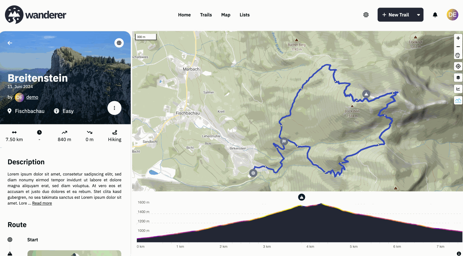
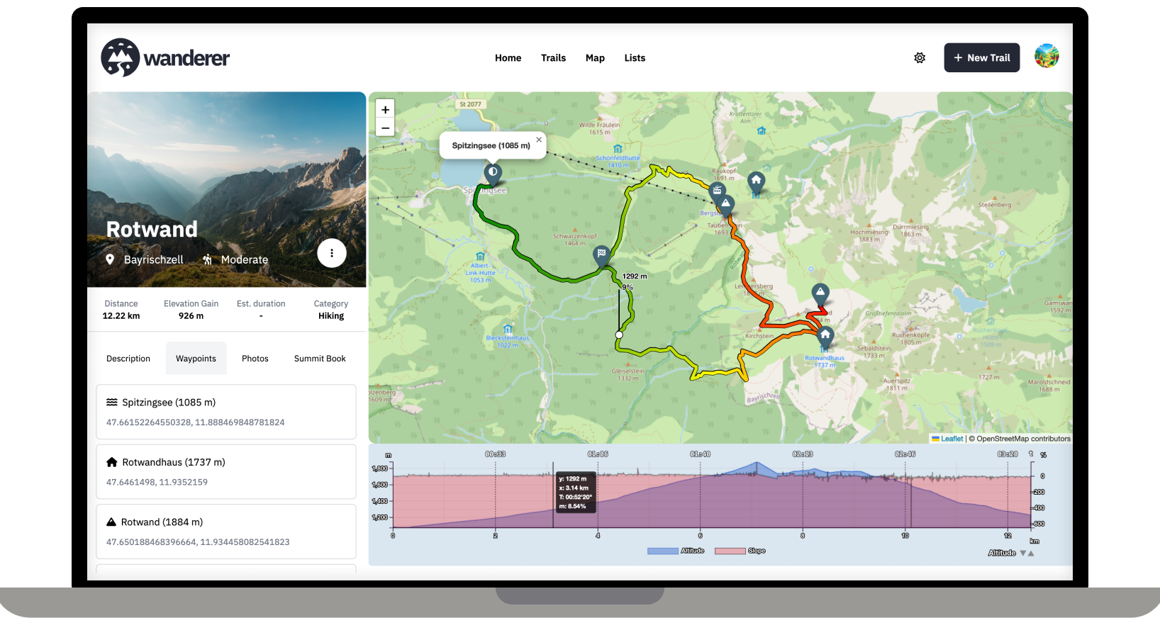
Hey everyone, #What is wanderer? wanderer is a self-hosted GPS track database. You can upload your recorded GPS tracks or create new ones and add various metadata to build an easily searchable catalogue. Think of it as a fully FOSS alternative to sites like alltrails, komoot or strava. #What is new? I'm coming back here to tell you a bit about what has been happening since my last update. Since then, we implemented some highly requested features:
Big thanks to everyone who contributed code or translations! If you have any suggestions/questions feel free to let me know below.
Have a great weekend!
Flomp
Yes, bulk imports are supported. You will need to download them from GOSLogger first though.
Hey everyone, wanderer recently celebrated it’s 10th anniversary. Well, as far as minor versions go at least.
First and foremost: What is wanderer? wanderer is a self-hosted GPS track database. You can upload your recorded GPS tracks or create new ones and add various metadata to build an easily searchable catalogue. Think of it as a fully FOSS alternative to sites like alltrails, komoot or strava.
Next: Thank you for almost 1.2k stars on GitHub. It’s a great motivation to see how well-received wanderer is.
By far the most requested feature since my last post was the possibility to track your acitivities. This is now possible on the new profile page which shows various statistics to help you gain better insights into your trailing/running/biking habits. Lists have also received a major upgrade allowing you easily bundle a multiday hike and share it with other users.
If you want to give wanderer a try without installing it you can try the demo. When you are ready to self-host it you can head over to wanderer.to to see the full documentation and installation guide. If you really like wanderer and would like to support its development directly you can buy me a coffee.
Thanks again! Cheers Flomp

Hey there,
it's been a while since my last post. Since then - with the help of this awesome community - I have added multiple new features and fixed a lot of bugs.
Most importantly there is now a working demo alongside a shiny new landing page.
And here are some more fun features I added since then:
And much more. I'd be happy if you give it a try in case you haven't yet.
GitHub repo: https://github.com/Flomp/wanderer
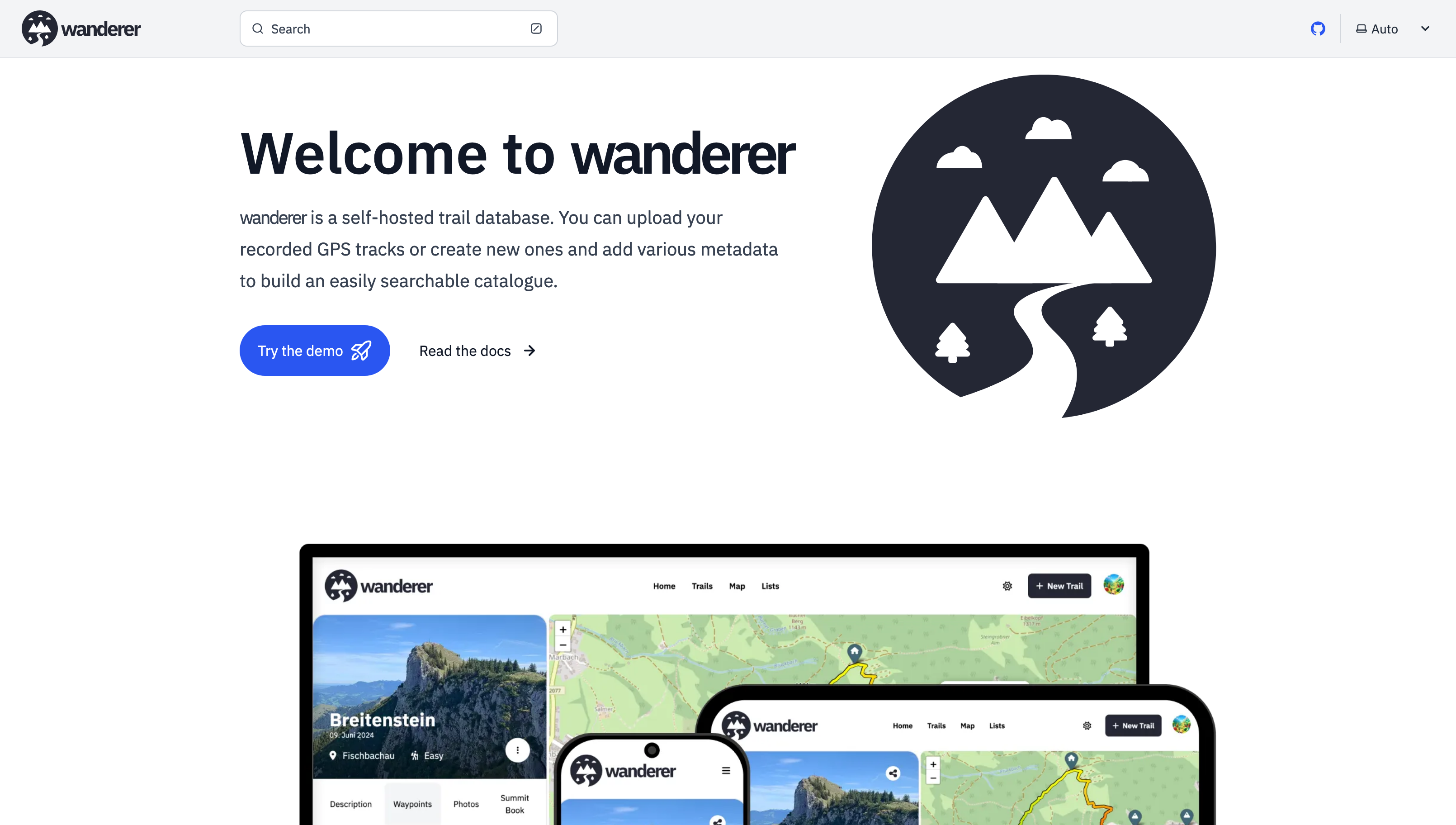
Over the last two months, I developed wanderer. It is a self-hosted alternative to sites like alltrails.com or in other words a self-hosted trail database. It started out more as a small hobby project to teach myself some new technologies but in the end, I decided to develop it into a fully-fledged application.
Core Features:
wanderer is completely open-source. You can find the GitHub repo here: https://github.com/Flomp/wanderer
wanderer is still under active development so if you encounter any bugs/errors or have suggestions please let me know here or open an issue on GitHub.
Sure, use your favourite app to track your workout and upload it to wanderer afterwards. It also supports auto uploads through a folder. So you can just place your workout file in the folder and wanderer does the rest.